![]()
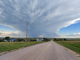
Although not forecasted, severe weather crossed portions of Northwest Nebraska on Friday afternoon as golf ball sized hail fell in Harrison.
According to the National Weather Service Storm Prediction Center in Norman, Oklahoma, by noon there was just enough of a disturbance in the atmosphere to trigger the development of supercells that are commonly associated with severe thunderstorms.
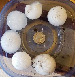
A special weather statement that was issued at 12:10 pm by the National Weather Service called for penny sized hail and 40 mph wind gusts, but by 1:00 pm reports of golf ball sized hail was reported to Chadrad news along with pictures of the hailstones.
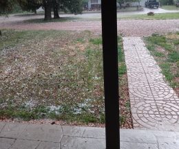
The winds never materialized according to one report made to Chadrad news which helped minimize any damage that may have occurred.
Another slight chance of wind and hail exists across Southwest South Dakota and the Nebraska Panhandle in Saturday’s latest forecast probabilities from the Storm Prediction Center.