![]()

Major Nebraska Rivers and their Drainages
Part 1 – The Big Blue, Little Blue, and Nemaha Rivers
By Gary Stone, Nebraska Extension water & integrated cropping systems educator gstone2@unl.edu
This six-part series will cover the major rivers and their respective drainages found in Nebraska, with some geography and history about Nebraska’s rivers.
Nebraska has abundant water sources with many streams, rivers, and groundwater. At times these rivers flood, creating devastation. While abundant, the amount of clean water is finite. This water irrigates over nine million acres of crops across the state, providing for our daily needs, riparian habitat for wildlife and fauna, many recreational opportunities, and aesthetics for the soul. Safe and respectful use of this essential resource is incumbent on all of us.
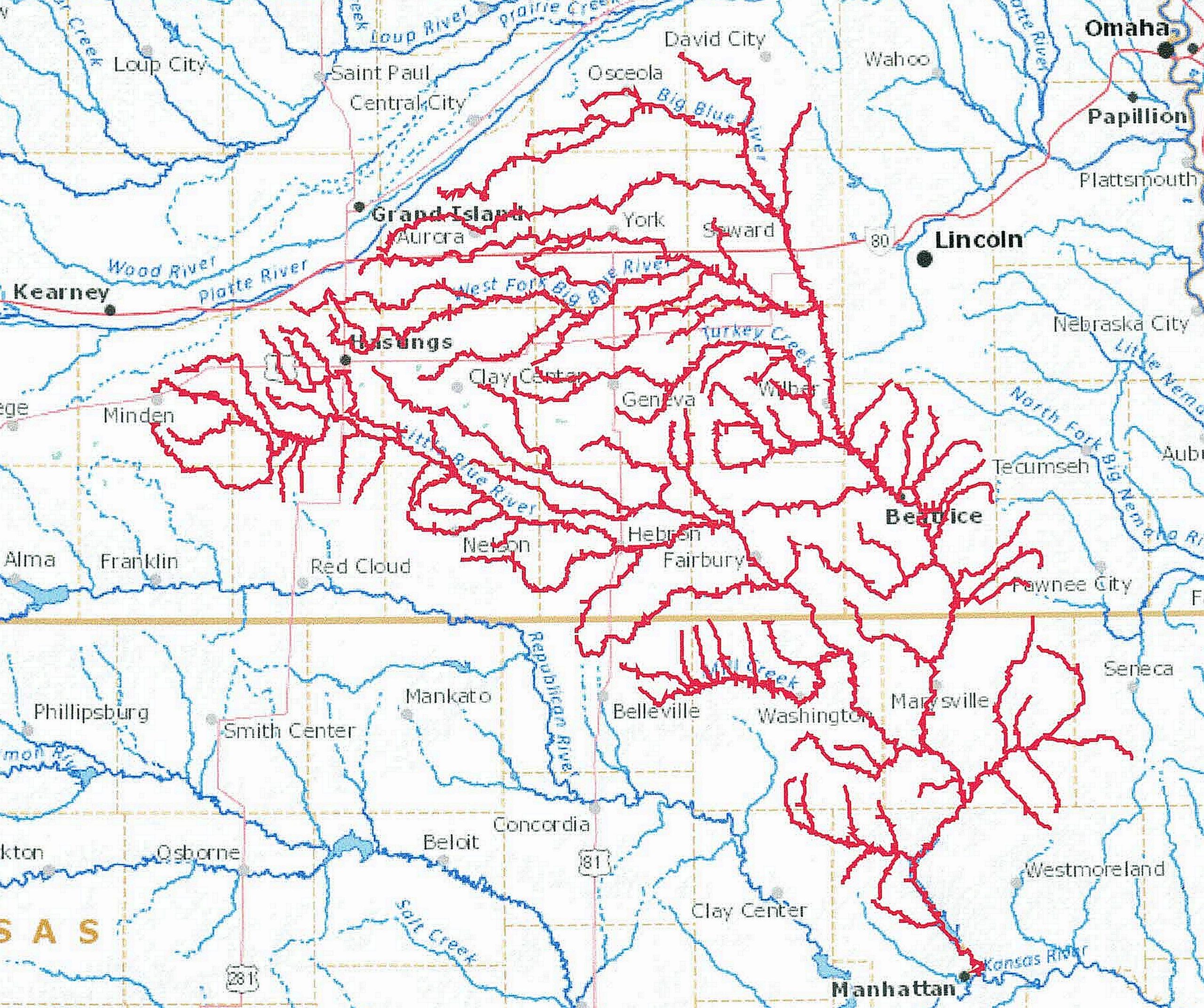
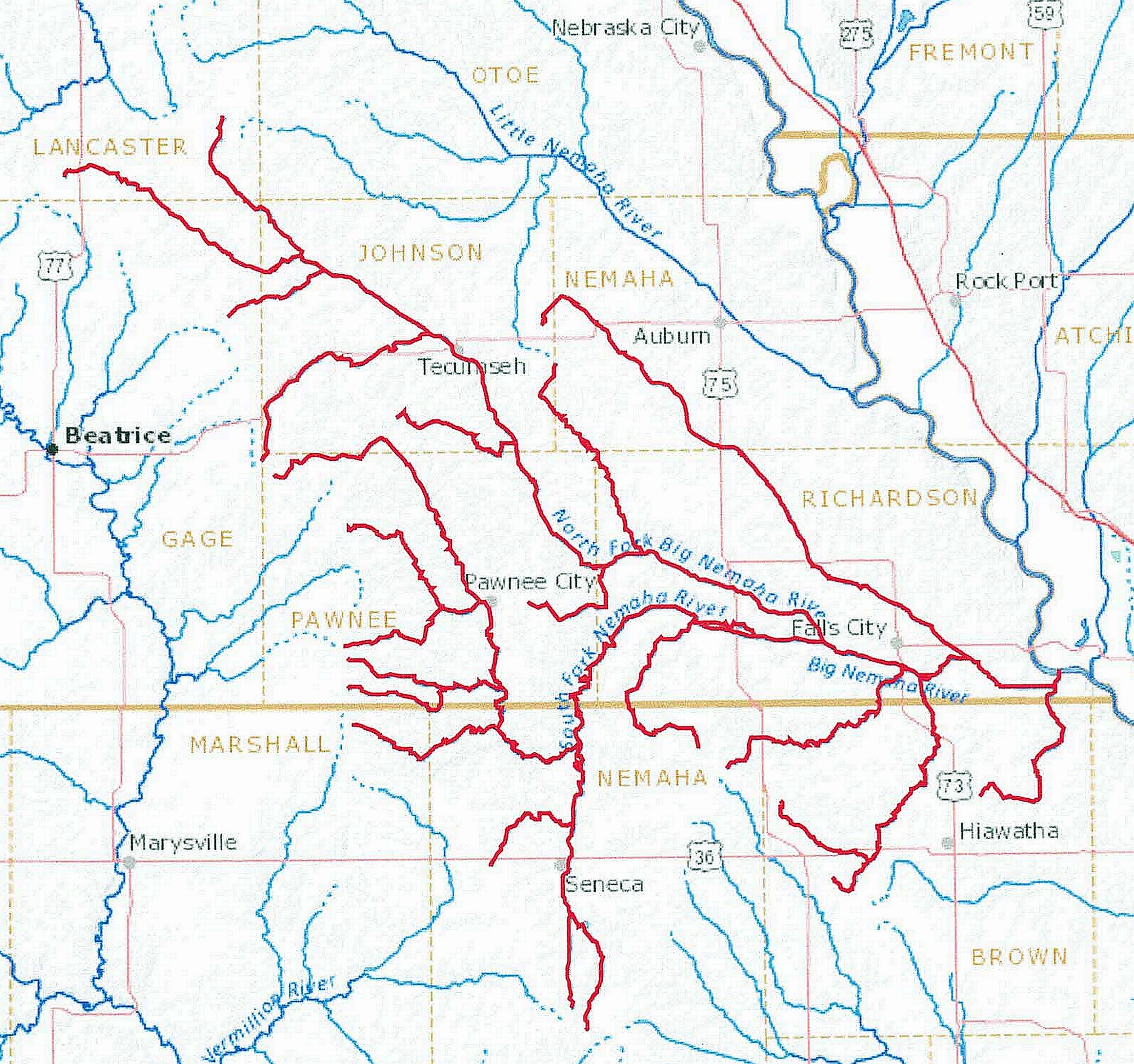
The Big Blue, Little Blue, and Nemaha River drainage systems are in south-central and southeast Nebraska. The headwaters of the Big Blue River are south of Marquette, Neb., east of Grand Island. The Little Blue River headwaters are south of Minden, Neb. The origins of the Nemaha rivers are south of Lincoln, Neb., and part of north-eastern Kansas.
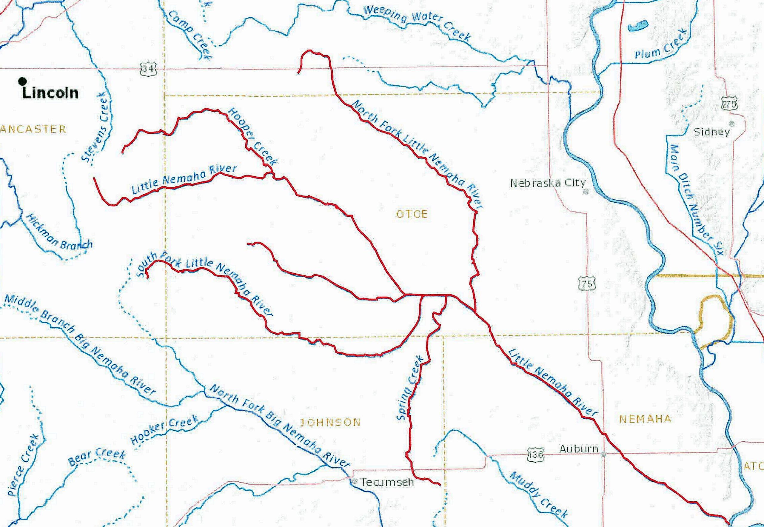
The Little Blue joins with the Big Blue near Blue Rapids, Kan. The Big Blue flows approximately 359 miles, entering the Kansas River east of Manhattan, Kan. The Big Nemaha River ends at the confluence with the Missouri River south of Rulo, NE. Finally, the Little Nemaha River ends at the junction with the Missouri River south of Nemaha, NE. All these river drainages have numerous smaller streams that feed into them.
During the 1800s, the Big Blue River provided power for water mills for grinding grain and, in the early 20th century, hydropower for early electric plants. The Oregon/California Trail followed closely with parts of the Little Blue River to Fort Kearney.
Crops grown in the area are corn, soybeans, grain sorghum, alfalfa, and small grains.
Four Natural Resource Districts (NRDs) combine to cover these drainages. They are the Nemaha, Upper Big Blue, Lower Big Blue, and Little Blue NRDs. The total combined area is 9,307 square miles. The Nebraska Natural Resource Districts manage the groundwater within their respective areas and work closely with the Nebraska Department of Natural Resources, which manages the surface waters across the state.
To view these river drainages and others across the United States, the United States Geological Survey (USGS) has a great website called Streamer (https://txpub.usgs.gov/DSS/streamer/web/). At the website, click “Go to Map.” From the new page, zoom in on the state. In the upper right corner of the page, click “Trace Upstream.” Zoom in and find the point you want to trace the river/stream upstream. A quick way to start is to click where the Mississippi River flows into the Gulf of Mexico near Pilottown. You will see the entire Mississippi River Drainage and quite a bit of the country. To see the Big Blue River Drainage, click on the river at the confluence with the Kansas River near Manhattan, Kan. If you know the river/stream headwaters/source, you can also use the “Trace Downstream” feature.
To view Nebraska’s water compacts and decrees with all the surrounding states, visit https://dnr.nebraska.gov/files/doc/about/statutes/CompactAndDecrees2010.pdf