![]()

Major Nebraska Rivers and Their Drainages
Part 5 – The Platte Rivers
By Gary Stone, Nebraska Extension water & integrated cropping systems educator gstone2@unl.edu
This is a six-part series on the major rivers and their respective drainages found in Nebraska with their geography and history of Nebraska’s rivers.
Nebraska is blessed with an abundance of water, with a multitude of streams, rivers, and groundwater. At times these rivers flood, creating unbelievable devastation. This finite resource of abundant, clean water serves to irrigate over nine million acres of crops across the state, provides for our daily needs, riparian habitat for wildlife and fauna, a multitude of recreational opportunities, and aesthetics for the soul. Safe and respectful use of this essential resource is incumbent on all of us.
The Platte Rivers drainage system is the largest and longest in the state. I say “rivers” because this drainage comprises the North Platte, South Platte, and from the confluence of these two to the Missouri River, the Platte River. The combined rivers in Nebraska run from the Panhandle at Henry, Neb. (North Platte) and near Big Springs, Neb. (South Platte) to the confluence with the Missouri River north of Plattsmouth, Neb.
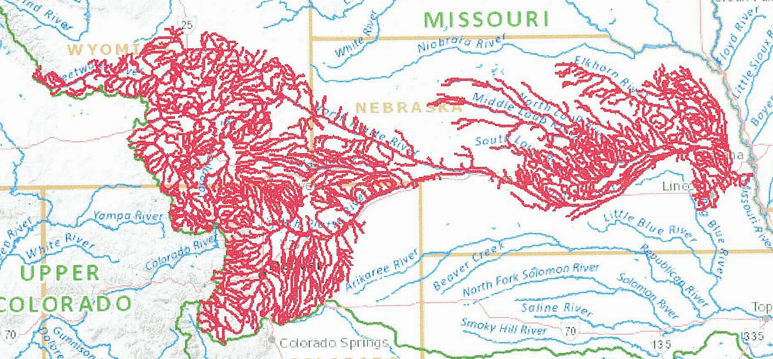
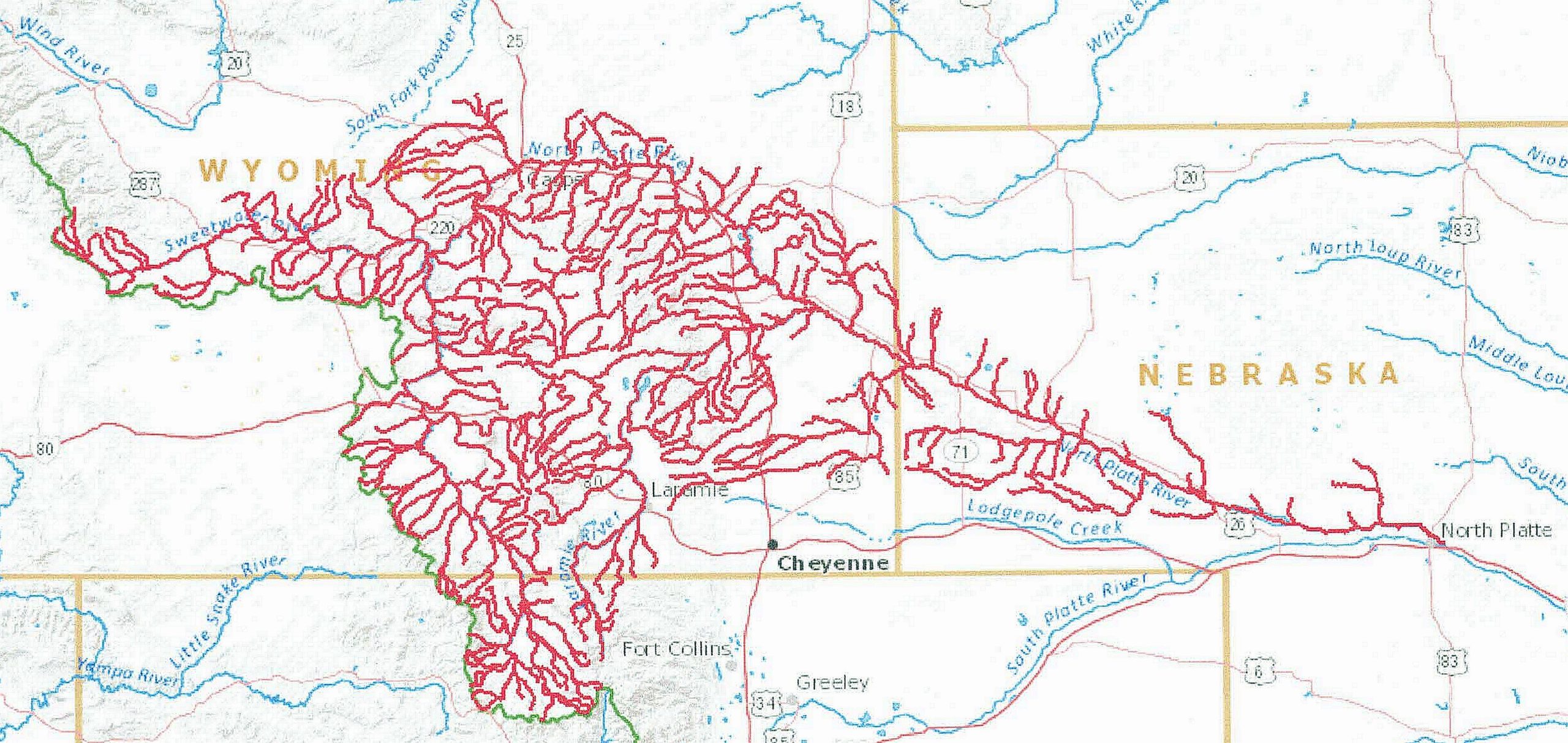
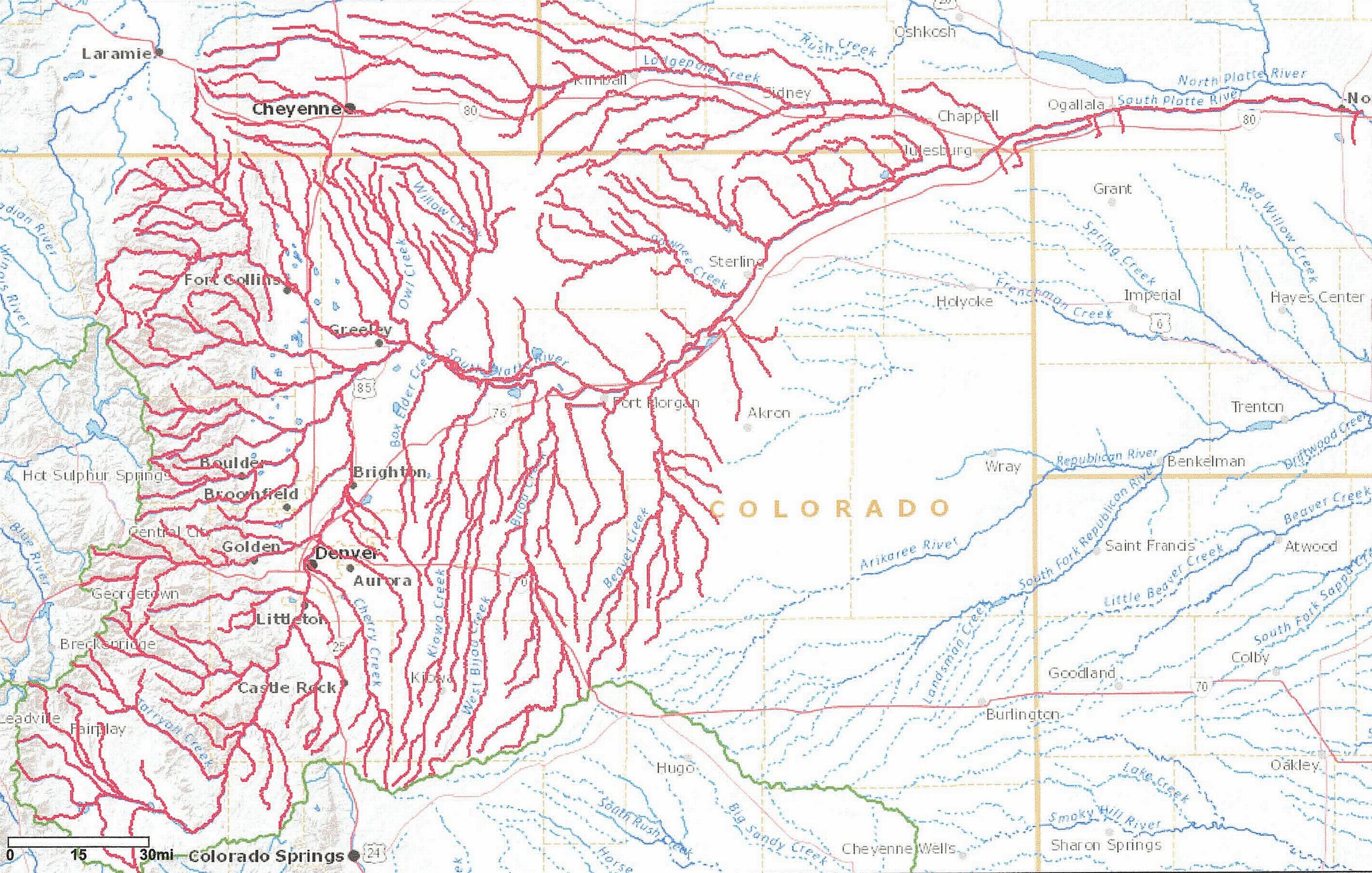
Both the North and South Platte Rivers have their headwaters in Colorado. The headwaters of the North Platte River are near Walden, Colo., in the north-central Rocky Mountains. The headwaters of the South Platte River are near Hartsel, Colo., in the east-central Rocky Mountains.
Numerous historical trails “followed the water” along most of the Platte / North Platte and Sweetwater Rivers across Nebraska and Wyoming. These include the Oregon, Mormon, Overland, California Trails, and the Pony Express.
The North Platte River is 716 miles in length to the confluence with the South Platte River east of North Platte, Neb. with the drainage basin covering approximately 30,900 square miles in Colorado, Nebraska, and Wyoming. The South Platte River is 439 miles in length to the confluence, with the North Platte River drainage basin covering approximately 24,300 square miles in Colorado, Nebraska, and Wyoming.
The Platte River is 310 miles in length from the confluence of the North and South Platte Rivers to the confluence with the Missouri River, with an average discharge of 7,037 cfs. One of the major wildlife migrations takes place each spring and fall through the “big bend” of the Platte River between North Platte and Grand Island. This is the crane migration through the North American Central Flyway consisting of over 600,00 cranes. Most are Sandhill cranes but Whooping cranes may also be seen. If you have not seen it, you are really missing a remarkable natural wonder. The combined drainage area of the entire Platte River basin is approximately 86,000 square miles in all three states. The Platte River drainage also includes the Elkhorn and Loup River drainages.
The North Platte River drainage was explored in my previous series, “The North Platte River – Multi-use Water,” which can be found at The North Platte River — Multi-use Water, Part 1 | CropWatch | University of Nebraska–Lincoln (unl.edu). Tributaries in Nebraska that feed the North Platte River include Horse Creek, Sheep Creeks, Winters Creek, Nine Mile Creek, Blue Creek, Pumpkin Creek, Birdwood Creek, and Rush Creek.
Lodgepole Creek is the major tributary of the South Platte River in Nebraska. The headwaters of Lodgepole Creek are located east of Laramie, Wyo. and its confluence with the South Platte River is at Ovid, Colo.
Wood River lies between the Platte River in the south and the South Loup River in the north. The headwaters are near Callaway, Neb., and the confluence with the Platte River is near Chapman, Neb.
Primary crops grown in this drainage area are corn, edible dry beans, sugar beets, alfalfa, winter wheat, soybeans, sunflowers, millet, forages, potatoes, and small grains.
Colorado, Nebraska, and Wyoming share the North Platte River waters and its use. How the water is divided and used is determined by the North Platte Decree. Colorado and Nebraska share the South Platte River and Lodgepole Creek waters and their use. The decree and compact Nebraska has with Colorado and Wyoming for these rivers can be found at CompactAndDecrees2010.pdf (nebraska.gov).
The entire Platte River drainage system in Nebraska consists of ten natural resource districts, the North Platte, South Platte, Twin Platte, Central Platte, Lower Platte North, Lower Platte South, Upper Elkhorn, Lower Elkhorn, Upper Loup, and Lower Loup NRDs. Total acres in the combined NRDs are 39,994 square miles or 52 percent of the state’s land area.
To view these river drainages, and others across the United States, the United States Geological Survey (USGS) has a great website called Streamer (https://txpub.usgs.gov/DSS/streamer/web/) At the website, click “Go to Map”. From the new page, zoom in on the state. In the upper right corner of the page, click “Trace Upstream.” Zoom in and find the point you want to trace the river/stream upstream. To see the North or South Platte River drainages, click on the respective river above their confluence east of North Platte, Neb. To see the entire Platte River drainage, click on the river above the confluence with the Missouri River near Plattsmouth, Neb. If you know the river/stream headwaters/source, you can also use the “Trace Downstream” feature.