![]()

Major Nebraska Rivers and Their Drainages
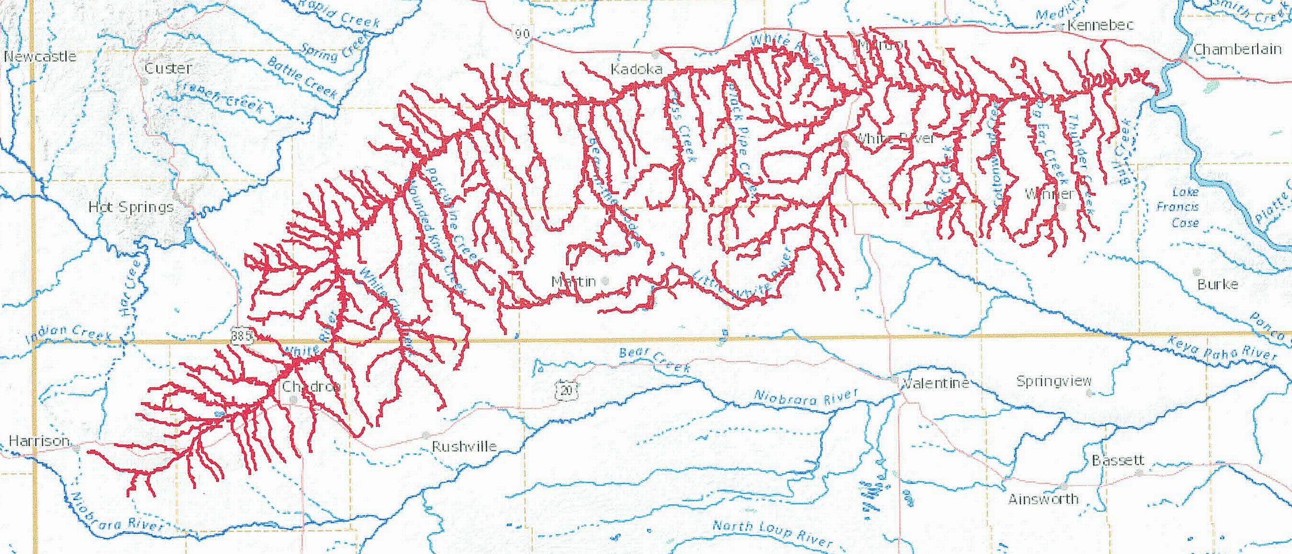
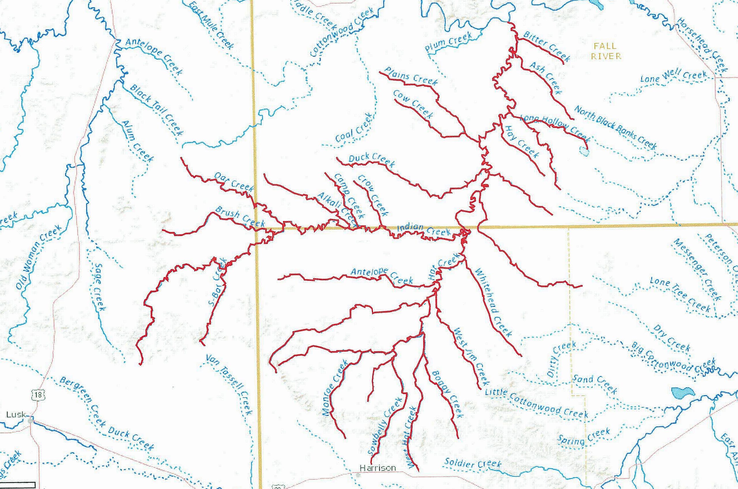
Part 6 – The Niobrara River, White River, and Hat Creek
By Gary Stone, Nebraska Extension water & integrated cropping systems educator gstone2@unl.edu
This is the final entry of a six-part series on the major rivers and their respective drainages found in Nebraska with their geography and history about Nebraska’s rivers.
Nebraska is blessed with an abundance of water, with a multitude of streams, rivers, and groundwater. At times these rivers flood, creating unbelievable devastation. This finite resource of abundant, clean water serves to irrigate over nine million acres of crops across the state, provides for our daily needs, riparian habitat for wildlife and fauna, a multitude of recreational opportunities, and aesthetics for the soul. Safe and respectful use of this essential resource is incumbent on all of us.
The Niobrara and White River drainage systems are in the northwest and northern Nebraska. The headwaters of the Niobrara are near Manville, Wyo. The White River headwaters are located southeast of Harrison, Neb.
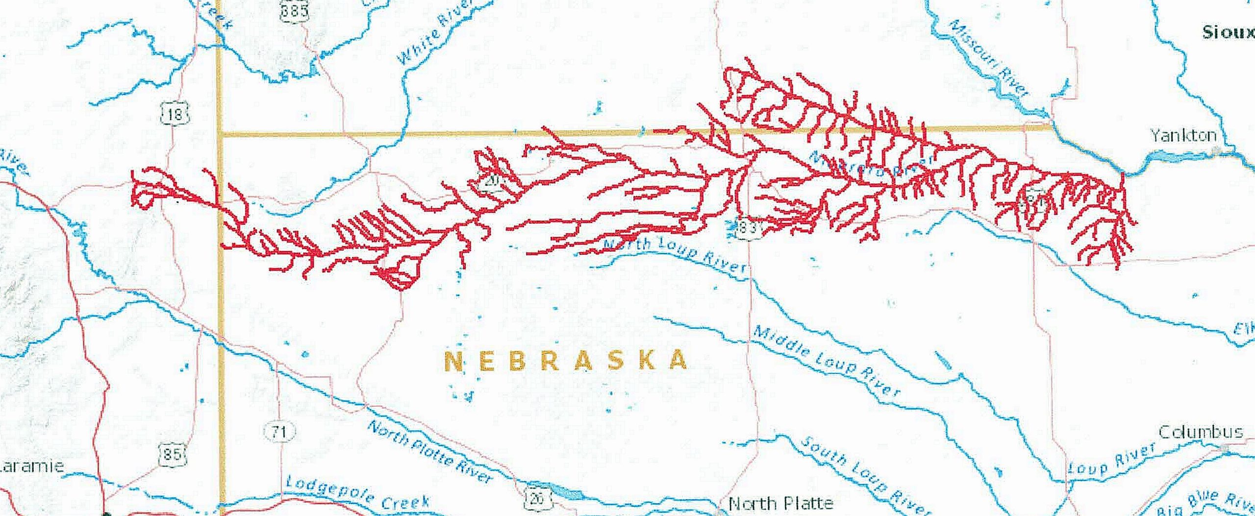
The Niobrara River ends at the confluence with the Missouri River near Niobrara, Neb. The Niobrara River flows for approximately 568 miles with an average discharge of 1,718 cfs. Major tributaries of the Niobrara River are the Keya Paha River and Snake River.
The White River ends at the confluence with the Missouri River south of Chamberlain, S.D. The White River flows for approximately 580 miles. Numerous tributaries feed the White River from the Pine Ridge in Nebraska and those across South Dakota.
There are two U.S. Bureau of Reclamation projects in the Niobrara River drainage. Box Butte dam and reservoir are located on the Niobrara River north of Hemingford, Neb. It has a capacity of 31,060 acre-feet. The reservoir provides irrigation water for the Mirage Flats Irrigation District. The project irrigates approximately 11,000 acres. Crops include corn, dry edible beans, winter wheat, sugar beets, and alfalfa, along with other grains and pasture.
Merritt dam and reservoir are located on the Snake River, a tributary to the Niobrara River, southwest of Valentine, Neb. It has a total capacity of 74,486 acre-feet. The reservoir provides irrigation water for the Ainsworth Irrigation District. The main line canal is lined with concrete to minimize seepage loss and is approximately fifty-three miles long. The project irrigates approximately 34,500 acres. Crops include corn, soybeans, alfalfa, and small grains.
The Spencer Dam and hydro powerplant is located on the river southeast of Spencer, Nebraska, and was operated by Nebraska Public Power District (NPPD). The dam failed during the 2019 major spring storm, which caused heavy flooding downstream. The remnants of the dam are to be demolished, but NPPD will retain the water rights to the river.
The White River and its tributaries have three irrigation districts which utilize part of that river’s flow. These are the Harris-Cooper, White River, and Whitney irrigation districts. Combined, these districts irrigate approximately 8,450 acres of alfalfa, small grains, and pasture.
Hat Creek is in the far northwestern part of the state. Hat Creek headwaters are located north of Harrison, Neb., and are fed by numerous streams out of Pine Ridge. Hat Creek ends with the confluence of the Cheyenne River, west of Angostura Reservoir in South Dakota. Water from this creek is used to irrigate pasture and provides water for livestock.
Numerous state recreational areas (SRA) managed by the Nebraska Game and Parks Commission are on the Niobrara River or its tributaries. Box Butte SRA is on the Niobrara River, and Cottonwood Lake SRA on Bear Creek near Merriman. Merritt Reservoir SRA is located on the Snake River, southwest of Valentine. Smith Falls SRA (the highest waterfall in the state) is located on the Niobrara River east of Valentine. Long Pine SRA is located on Long Pine Creek, and Keller Park SRA is located on Bone Creek, both near Ainsworth, Nebraska.
Niobrara State Park is located at the confluence of the Niobrara River and the Missouri River. There is a seventy-six-mile stretch of the Niobrara River from Valentine east to Nebraska State Highway 137, which has been designated a National Scenic River. The U.S. Fish and Wildlife Service manages the portion of the river that flows through the Fort Niobrara Refuge, and the National Park Service manages the remaining sixty-seven miles of the river. Agate Fossil Beds National Monument and the Pink Schoolhouse are located on the Niobrara River, north of Mitchell, Nebraska.
There are three Natural Resource Districts (NRDs) combined that cover these drainages. They are the Upper Niobrara White, Middle Niobrara, and the Lower Niobrara. The total combined area is 14,179 square miles.
All our rivers, streams, creeks, and riparian areas across the state provide a multitude of resources, including clean water for domestic and livestock use, irrigation for crops and food, recreation, aesthetic opportunities, wildlife habitat, and fauna. Being a little biased, I would submit that the Platte River system is the crown of the state and that the Niobrara River is the crown jewel. Floating the Niobrara River should be on everyone’s list. Whether by canoe, kayak, tubing, or tanking (it is a Nebraska thing – check it out!), you need to do it. Hint: go during the middle of the week when there are fewer visitors on the river and enjoy!
To view these river drainages and others across the United States, the United States Geological Survey (USGS) has a great website called Streamer https://txpub.usgs.gov/DSS/streamer/web/ At the website, click “Go to Map.” From the new page, zoom in on the state. In the upper right corner of the page, click “Trace Upstream.” Zoom in and find the point you want to trace the river/stream upstream. To see the Niobrara River and White River drainages, click on either river near their respective confluence with the Missouri River. If you know the river/stream headwaters/source, you can also use the “Trace Downstream” feature.
To view all of the water compacts and decrees Nebraska has with all the surrounding states visit https://dnr.nebraska.gov/sites/dnr.nebraska.gov/files/doc/about/statutes/CompactAndDecrees2010.pdf .
With this finite resource, what is water worth? Now and for the future?