![]()
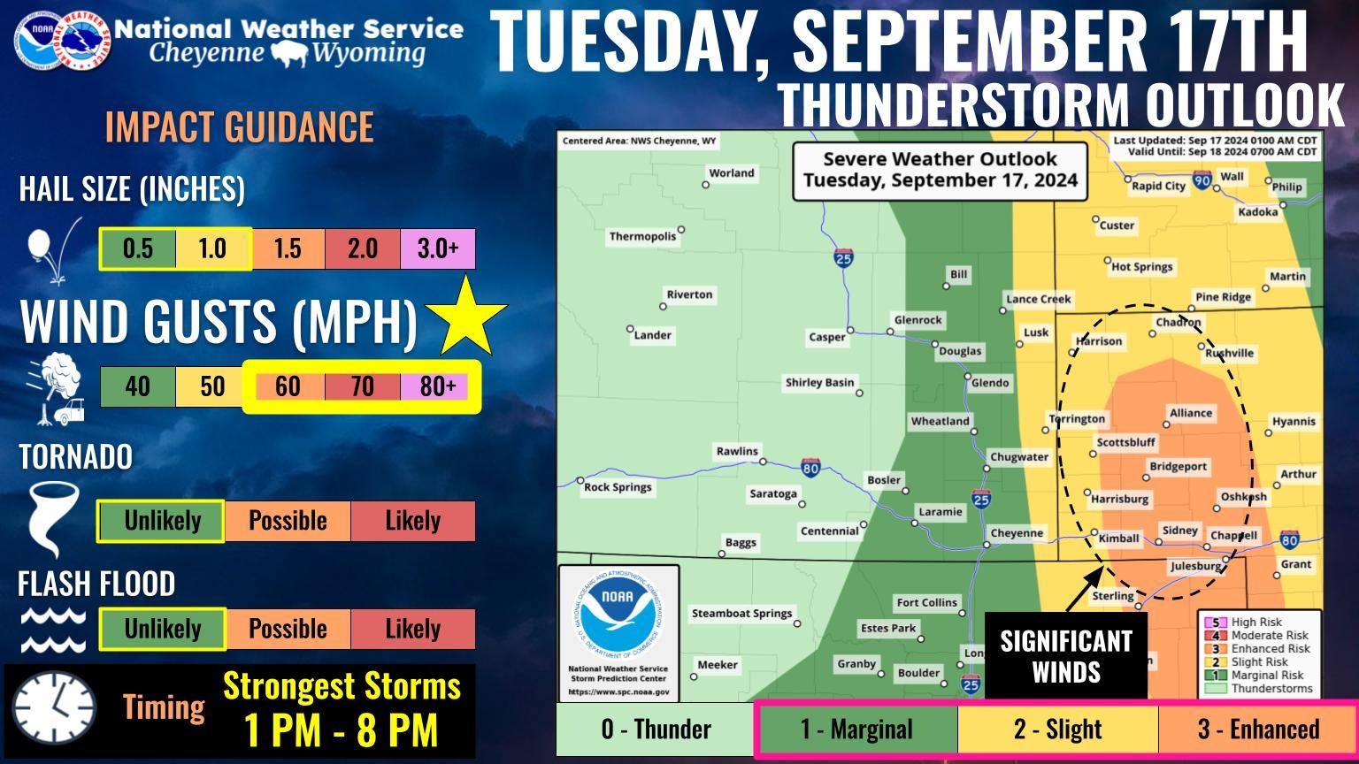
The National Weather Service in Cheyenne has published a significant weather advisory for Tuesday. Although severe conditions and heavy rainfall is possible, according to the NWS, the primary hazard is strong winds.
Areas in eastern Wyoming and the Panhandle of Nebraska can expect to see wind gusts in excess of 60 mph. According to the NWS, a strong weather system that is atypical for this late in the season regarding severe weather is expected to sweep through the area today, along with a strong cold front. This front is expected to produce a line of strong to severe thunderstorms, which will move east-northeast across the high plains through Tuesday evening.
Weather forecasts are trending higher with this event becoming a potential derecho, which we have not had in our area since 2020.
The last time Chadron saw winds of this scale was in November of 2022, which brought 65 mph winds strong enough to knock out power lines across town and prompt a no travel advisory.